Up next in 10

Autonomous undersea mapping: Terradepth wants to change the way the Navy sees the sea
Apr 27, 2026

While every inch of terrestrial land on earth is mapped, the sea floor remains a mystery in many places. Terradepth wants to shed some light on the problem.
Show More Show Less View Video Transcript
0:00
I'm Joe Wolfel, CEO and founder of Teradepth
0:05
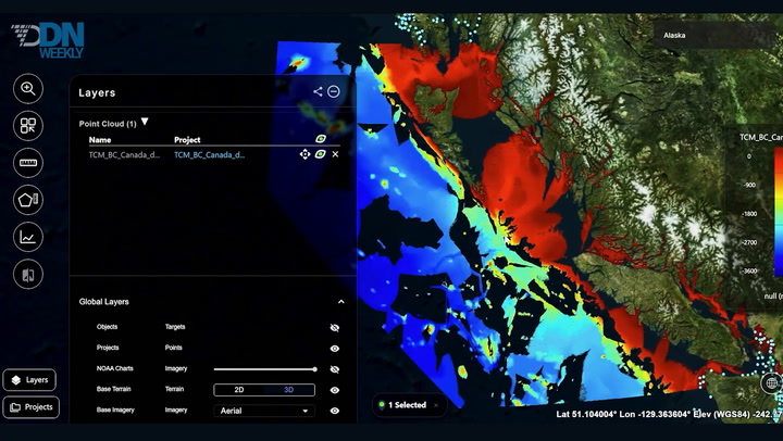
So Teradepth is a seabed intelligence company, and we've built an ecosystem that we call the ocean operating system
0:11
And it's comprised of three layers. And really what we're apt to do is solve the big problem that humanity has
0:16
with just a lack of understanding with respect to the seafloor. We really haven't mapped much of the earth
0:22
and it shows in the decisions that we make or the decisions that we don't make. So our three-layer operating system really is involved with data acquisition
0:30
How do we scale that? How do we get high-resolution understanding of the seafloor? And once we get that data, it all has to go somewhere
0:37
Previously, that data would sit on hard disk drives in government safes or, say, in a closet with a yellow sticky note on it
0:44
So we created a software architecture that makes it really easy for people to upload, download, visualize, share
0:49
or keep secure that high-resolution ocean data that's been collected so that we can use it and make good decisions from it
0:56
And that third layer is really around what kind of applications are we building
1:00
on top of that intelligence layer so that we can make good, fast decisions
1:04
For example, if you're an oil and gas company and you want to understand
1:08
if you need to dredge so your liquid natural gas tankers don't run aground, we can write an application on top of the geospatial platform
1:14
that tells you when you need to dredge in a predictive way based on different factors and things like that So really those three layers come together to deliver an inherent capability so that we can make better faster decisions with again what we do and don do on the seabed what down there what not there
1:30
From a government perspective, is a strait of interest, mind or not
1:35
And what we can do is we can go out, we can get a baseline, we can put the data in a platform that allows us to see what's there
1:42
and then go do a resurvey to see if anything's changed. So, for example, we've got millions of barrels of oil going through the Straits of Hormuz and other choke points
1:53
These choke points are traditionally very difficult to survey based on currents that go through
1:58
because once land comes together, it creates effectively a venturi effect where these currents are high
2:04
And so that makes it really difficult for existent robotic sensors to go out and get good maps
2:09
What we've done at Teradepth is we've created a high-speed, high-endurance robotic system
2:13
that can deal with those environmental factors. So not only can we get the information in the first place
2:19
but then we can put it into a software architecture that makes it really easy and, more importantly, fast
2:24
for critical decision makers to access that data. So, for example, in the current geopolitical situation
2:30
had we done high-resolution mapping before hostilities commenced, we could go do point collections now
2:36
and we'd have a much better understanding of what has changed or what has not changed since hostilities commenced
2:41
So this is a model of that high endurance high speed platform And what makes this really special is that we carry tens of millions of dollars worth of batteries in a few hundred dollars worth of diesel fuel
2:53
That gets us a really a tritable, meaning we can lose it, data collection capability that can also handle speeds in those areas of interest
3:01
like those choke points, where those currents can be higher to the point
3:05
where you can't actually launch robotic assets. And so this allows us to, one, get the collection done in the first place
3:11
but two, really drop that cost of data acquisition because these things can stay out so long
3:16
and be self-supporting that we don't actually need humans babysitting the robots out there
3:21
which is generally how we have to do business today in the absence of a platform like this
3:25
So the real one is nine meters in length and one meter in diameter
3:29
So we use these assets as captive assets within Teradep. So we currently aren't selling these
3:34
because really what we want to do is provide people the data and the information they need on demand
3:40
So I don't want to sell you a robot. I want to sell you the solution to the problem that you have
3:45
We use a variety of different assets, but yeah, these are shippable worldwide
3:49
People really focus on robots. They focus on the fact that they think a cool, sexy robot is going to provide a capability
3:58
And that's just not true. Like robotic products, and it's great. Looking around here everybody making really cool robots Highly capable exquisite technology It like magic But those robots have to exist within an ecosystem that enables better faster decision So a robot in and of itself is not gonna create a capability
4:16
You need hardware, you need software, you need a culture that basically allows us
4:21
to pull these things together to create a coherent capability and really better, faster decision-making across the board
4:27
Our audience and our customer base is really critical decision-makers. So think about military commanders
4:32
government decision-makers, offshore energy executives, people like that. But we've also created the platform to be both highly technical and easy to use
4:40
So it does actually solve problems with even your hydrospatial experts out there
4:46
And we really created a capability that didn't exist because nobody created an integrated software architecture
4:52
because ocean data was so sparse a siloed. So that's why the company really had to focus on those three layers that I mentioned
4:59
data acquisition, data aggregation and integration, and those applications and appliances at about the same time
5:05
So we think that this technology is really going to be a game changer for improving the way that humans make decisions under the water in general
5:13
And we're really looking forward to aggregating, integrating other technologies as those become available
5:19
because really what we're building is this infrastructure that's going to advance human understanding
#news