Up next in 10


The U.S. and India officially launched NISAR, a new satellite designed to monitor changes to Earth’s surface and atmosphere.
Show More Show Less View Video Transcript
0:00
5, 4, 3, 2, 1, 0
0:05
All L-14 is generating nominal thrust. The United States and India are teaming up to keep an eye on Earth's ever-changing landscape
0:13
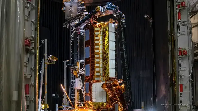
The satellite, called NISAR, lifted off on July 30th from southern India
0:18
It will scan the Earth every six days for the next five years. The data provides scientists with key data on earthquakes, melting glaciers, and more
0:26
So what NISAR is actually observing is changes in vegetation and vegetation cover
0:34
as well as changes to the ground surface underneath. From those images, scientists will be able to see what is going on both on the surface and inside Earth
0:44
In the United States, NISAR tracks earthquakes and volcanoes on the West Coast
0:48
In the Southeast, NISAR tracks hurricane floodwaters. And in the Midwest, NISAR can see land subsidian sets due to groundwater pumping and then recharge
0:58
For farmers, that information is key for tracking crops. So NISAR is definitely going to be a breakthrough for field soil moisture which is one of your main drivers of both food security and then as well more on the economic commodity forecasts The current land surface models can really quantify irrigation So
1:17
9STAR is going to now help understand how much water is actually being used to grow a crop
1:22
which will help us save water. So that's kind of a big deal
1:26
As a result, farmers will better understand what's happening underneath the ground
1:30
The images will help them decide if they are watering too much, too little
1:34
Are they in a drought? When farmers do well, everyone benefits. Scientists say NISAR might also predict natural disasters
1:41
They were going to be able to actually start studying these tiny little almost landslides
1:47
these little tiny quakes. And the goal, of course, being that we find a signature
1:54
that happens before a major disaster that would allow us to then look for that and search for it
2:01
and almost be able to predict these big disasters before they happen
2:05
Unlike other satellites, NISAR will be able to see through clouds. This means it can monitor Earth during storms and in darkness
2:13
For Straight Arrow News, I'm Kaylee Carey. Find the full story right now by downloading the Straight Arrow News mobile app today
#news
#Earth Sciences
#Atmospheric Science