
Poland's Borders Are Wrong
Sep 11, 2026


Use COUPON CODE GK51 for 51% OFF Any Yearly Membership to World Anvil: https://worldanvil.com/?c=GK
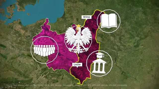
When you look at statistical maps of Poland today, you're likely to notice a 'Phantom Border' where its old borders used to be. This is because modern maps show a completely different Poland than the one that dominated European history for centuries. In 1945, the Soviet Union & the Allies picked up the entire nation of Poland and shifted it over 200 kilometers to the west. This roughly matched the territory of its original medieval kingdom, but also lost about half of its pre-war homeland (including cultural capitals like Lwów and Wilno) to the USSR. Today, the scars of the Kresy borderlands, the unresolved tension around Russia's Kaliningrad military exclave, and dormant irredentist claims on Vilnius and Western Ukraine reveal why many believe Poland's current borders are wrong.
TIMESTAMPS:
00:00 A Nation Moved by Force
00:57 The Original Medieval Kingdom
01:54 Conquering the East: The Commonwealth
03:22 Erased From The Map
04:34 Irredentism & Survival of Polish Culture
05:11 WorldAnvil
06:44 Post-WW1 Border Wars
09:37 1945 Displacement
12:24 Claim on Vilnius & Part of Lithuania
13:43 The Belarusian Borderlands
14:45 Western Ukraine
16:11 Russia's Baltic Enclave: Kaliningrad
17:32 Modern Abandonment of Most Claims
Stay up to date on more content from me:
Show More Show Less #education