Up next in 10

A Laser Scan Found Something Under This Jungle — Then They Realized It Was a Lost City
Jul 5, 2026

A researcher opened old LiDAR laser scans of the jungle in Campeche, southern Mexico — and noticed something that should not have been there.
Straight lines. Raised platforms. Empty squares hidden beneath the trees.
At first, it looked like noise in the data. But the longer researchers looked, the more the jungle began to disappear… and a lost Maya city started to appear.
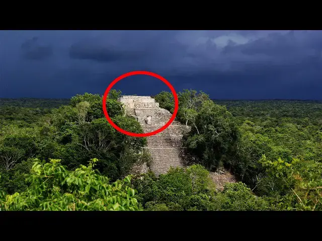
Hidden beneath the forest canopy was Valeriana — an ancient Maya city with pyramids, plazas, roads, a ballcourt, water systems, and thousands of structures that had been almost invisible from the ground.
The most incredible part? Nobody was searching the jungle for a lost city. The data had been collected years earlier for a completely different reason.
This is the story of how old laser scans revealed a forgotten Maya city beneath the trees — and why this discovery may change what we think is still hidden under the jungle.
What else do you think is waiting beneath the forest?
Sources:
https://www.reuters.com/world/americas/lost-mayan-city-discovered-southern-mexico-jungle-2024-10-29/
https://www.theguardian.com/world/2024/oct/29/lost-maya-city-valeriana-mexico-temple-pyramids-plazas
Show More Show Less View Video Transcript
0:00
October 2024, Campeche, Southern Mexico.
0:03
A researcher was looking at old laser
0:05
scans of a jungle when he noticed
0:07
something that should not have been
0:09
there. Straight lines, raised platforms,
0:12
empty squares hidden beneath the trees.
0:14
At first, it could have looked like
0:16
noise in the data, a mistake, a shadow,
0:19
a strange pattern caused by the forest.
0:21
But the longer he looked, the more the
0:23
map began to change. One line became a
0:25
road. One raised shape became a
0:28
platform. One empty space became a
0:30
plaza. Then another appeared, and
0:32
another, until the pattern was
0:34
impossible to ignore. This was not
0:36
nature. This was not random. Hidden
0:38
beneath the jungle canopy was a lost
0:41
Maya city. For years, people had driven
0:44
near this area without knowing what was
0:46
just beyond the road. Farmers had worked
0:48
nearby. Modern life had moved around it.
0:51
And under the trees, almost invisible
0:53
from the ground, were pyramids, plazas,
0:56
a ball court, water systems, and
0:58
thousands of ancient structures. The
1:01
strangest part was that nobody had gone
1:03
into the jungle looking for it. The data
1:05
that revealed the city had been
1:07
collected more than a decade earlier for
1:09
a completely different reason. So, how
1:11
does an entire city disappear beneath
1:13
the forest? How did lasers find what
1:15
human eyes could not? And what does this
1:18
discovery reveal about the Maya world
1:20
still hidden under the jungle? Let's get
1:22
into it. The story begins in 2013. A
1:25
plane flew over part of Campeche in
1:27
Southern Mexico carrying a powerful
1:30
scanning system called LiDAR. LiDAR
1:32
stands for light detection and ranging.
1:35
In simple terms, the aircraft sends
1:37
laser pulses down toward the ground.
1:39
Some of those pulses hit the tops of
1:41
trees. Some hit branches. But some pass
1:44
through tiny openings in the forest
1:46
canopy and reach the ground below. Then
1:48
a computer uses all of that information
1:50
to build a map. And this is where it
1:52
becomes almost unbelievable. The
1:54
computer can digitally remove the trees.
1:56
The jungle disappears, and suddenly the
1:59
shape of the land underneath becomes
2:01
visible. Hills, ridges, [music]
2:03
terraces, roads, platforms, pyramids,
2:06
things that would be almost impossible
2:08
to see while standing in the forest can
2:10
appear clearly from above. But in 2013,
2:13
this flight was not searching for
2:15
ancient cities. It was part of an
2:17
environmental project connected to
2:19
monitoring forests and land use. The
2:21
purpose was not archaeology. It was not
2:24
treasure hunting. It was not a dramatic
2:26
expedition into the unknown. The
2:28
information was collected, stored, and
2:30
for years it waited. Then, more than a
2:32
decade later, researcher Luke All Thomas
2:35
began looking through old lidar data,
2:38
and that is when the jungle started
2:39
giving up its secret. At first, the
2:42
images may not have looked like much to
2:44
an ordinary person. A few bumps in the
2:46
landscape, a few lines, a few strange
2:49
shapes beneath the trees. But to someone
2:51
trained to read ancient landscapes,
2:53
those shapes were not random. Nature
2:55
does not usually build straight
2:57
causeways. It does not arrange platforms
3:00
around plazas. It does not place
3:02
pyramids beside ceremonial ball courts.
3:04
The more researchers examined the scans,
3:06
the clearer it became. This was not one
3:09
hidden structure. It was a whole ancient
3:11
settlement, a dense Maya city that had
3:14
been sitting beneath the forest almost
3:16
invisible while the modern world passed
3:18
nearby. The city was later called
3:20
Valeriana, named after a nearby lagoon,
3:23
and it was not small. Across the scanned
3:26
area, researchers identified more than
3:28
6,000 structures. That number matters
3:31
because when most people imagine a lost
3:33
city, they picture one pyramid buried in
3:35
vines or a few broken stones hidden in
3:38
the jungle. But Valeriana was different.
3:41
The laser maps showed temple pyramids,
3:42
[music]
3:43
enclosed plazas, housing platforms, a
3:46
ball court, agricultural terraces, a
3:49
reservoir or dammed water system, and
3:51
broad connections between different
3:53
parts of the settlement. On the map, the
3:55
city did not appear all at once. First
3:57
came one platform, then another, then a
4:00
plaza, then a road connecting one
4:02
cluster to the next, then ceremonial
4:04
spaces, then water systems, then dense
4:07
groups of buildings spread across the
4:09
landscape, and finally, the pattern
4:11
became impossible to deny. This was
4:14
urban planning. This was a city, a place
4:17
where people lived, worked, gathered,
4:18
played, worshipped, stored water, built
4:21
homes, and shaped the land around them.
4:23
And that is what makes Valeriana so
4:25
powerful. For a long time, many people
4:28
imagined parts of the Maya lowlands as
4:30
scattered ruins separated by empty
4:33
jungle. A city here, a temple there, a
4:36
few settlements spread across the
4:38
forest. But lidar has been changing that
4:40
picture again and again. Laser scans
4:43
have shown that what looks like
4:45
untouched jungle today was often an
4:47
ancient human landscape. Roads hidden
4:50
under roots, farms covered by trees,
4:52
homes buried under soil, water systems
4:54
swallowed by vegetation. Valeriana adds
4:57
to that bigger story because this was
4:59
not a lonely ruin in the middle of
5:01
nowhere. It was part of a much larger
5:03
world, a world where Maya communities
5:06
engineered their environment, built
5:07
dense settlements, managed water, and
5:09
connected different areas across the
5:11
landscape. Some estimates suggest that
5:14
Valeriana may have supported tens of
5:16
thousands of people at its peak. But
5:18
that does not mean every detail is fully
5:20
proven yet. Lidar is powerful, but it is
5:22
not magic. It can reveal shapes on the
5:25
ground. It can show where structures
5:27
appear to be. It can expose patterns
5:29
that are impossible to see from the
5:31
forest floor. But archaeologists still
5:33
need field work. They still need to go
5:35
to the site. They need to examine the
5:37
structures directly. They need ceramics,
5:39
dates, excavations, and careful study
5:42
before every detail can be confirmed.
5:44
So, So responsible way to understand
5:46
this discovery is not to say that lasers
5:48
answered everything. They did something
5:50
better. They showed where the questions
5:52
are. And in archaeology, that can change
5:54
everything. Imagine standing in the
5:56
jungle without the laser map. All around
5:58
you are trees, vines, insects, uneven
6:01
ground. You might walk right past an
6:03
ancient platform and think it is just a
6:04
hill. You might cross an old causeway
6:07
and never realize it was built by human
6:09
hands. You might stand near the remains
6:11
of a plaza and see only forest. That is
6:14
why this discovery feels so strange. The
6:17
city was not lost because it was
6:18
impossibly far away. It was lost because
6:21
the jungle had become too good at hiding
6:23
it. [music] Trees covered the buildings,
6:25
roots broke through stone, soil softened
6:28
the edges, and centuries of growth
6:30
turned architecture into landscape.
6:32
Eventually, what had once been a city
6:34
became invisible. But it did not
6:37
disappear completely. The stones were
6:39
still there. The platforms were still
6:41
there. The shape of the city was still
6:43
written into the ground. It just needed
6:45
a different kind of eye to see it. And
6:47
that eye was laser light from the sky.
6:49
The laser did not see the jungle the way
6:51
people do. It saw through the gaps. It
6:54
reached the ground. It turned the forest
6:56
into data. And inside that data,
6:58
Valeriana appeared. This is why the
7:00
discovery is so exciting. It is not only
7:03
about one city. It is about how many
7:05
more may still be hidden. If old
7:07
environmental data can reveal a Maya
7:09
city by accident, what else is sitting
7:11
unnoticed in archives? What other scans
7:14
were collected for roads, forests,
7:16
farms, or climate research? What other
7:19
ancient places are already recorded
7:21
somewhere waiting for the right person
7:23
to look closely? That is one of the most
7:25
fascinating parts of this story. The
7:27
discovery did not begin with someone
7:29
cutting through the jungle with a
7:30
machete. It began with someone looking
7:32
again at information that already
7:34
existed, a forgotten data set, a
7:36
computer screen, a pattern most people
7:38
would never notice. And then, suddenly,
7:41
a lost city. Valeriana also reminds us
7:44
that ancient civilizations were never
7:46
simple. The Maya did not just build
7:48
isolated temples in the forest. They
7:50
built cities. They planned spaces. They
7:53
created ceremonial centers. They shaped
7:55
water systems. They played ritual ball
7:57
games. They constructed homes,
7:59
platforms, roads, and public areas. And
8:02
when the city was alive, the place that
8:04
looks quiet today may have been full of
8:06
movement. People crossing plazas,
8:08
children running between homes, workers
8:11
carrying materials, farmers managing
8:13
fields, water being stored, controlled,
8:15
and shared. The jungle we see now was
8:18
once a living city. Then, time passed.
8:21
Political systems changed. Populations
8:23
shifted. Buildings were abandoned. The
8:26
forest returned. And little by little,
8:28
Valeriana disappeared from human memory.
8:31
But the story is not finished.
8:32
Researchers still need to confirm more
8:34
of the structures on the ground. They
8:36
need to understand how old different
8:38
parts of the city are. They need to
8:40
learn how people live there, how the
8:42
settlement grew, and why it was
8:44
eventually abandoned. But even now, the
8:47
message is clear. The jungle was never
8:49
empty. It was holding a city, and maybe
8:52
many more. So, the next time you see a
8:54
satellite image of endless green forest,
8:57
remember Valeriana. Remember the old
8:59
laser scans. Remember the researcher who
9:01
looked at the data and saw what everyone
9:03
else had missed. Because sometimes, a
9:06
lost city is not found by walking into
9:08
the jungle. Sometimes, it appears on a
9:10
screen, line by line, point by point,
9:13
until the forest disappears and the past
9:16
comes back into view. If you enjoyed
9:18
this story, like the video, subscribe
9:20
for more strange discoveries, and hit
9:22
the notification bell so you never miss
9:24
the next one. And tell us in the
9:25
comments, if lasers can reveal a lost
9:28
city under the jungle, what else do you
9:30
think is still hidden beneath the trees?
#Jobs & Education