Up next in 10


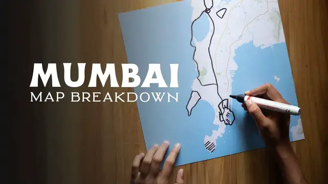
Snehal breaks down the map of South Mumbai & its history.
Mumbai, the seaside port formerly known as Bombay, is one of the largest cities in India. This city has a history so old that it requires quite a bit of time to wander through it all. In this map breakdown, you will understand how the geography of this island shaped the city as it is today and how to find your way around.
Snehal's Channel: http://www.youtube.com/snehal
Learn more about Bright Trip at https://www.brighttrip.com/courses?utm_source=youtube&utm_medium=video&utm_campaign=mumbai-map-explained
Leave a comment with any questions you have and we’ll make sure to include it in a future video.
Make sure to subscribe to the channel to learn how to travel smarter.
===== FOLLOW ON SOCIAL =====
Bright Trip Newsletter: https://mailchi.mp/brighttrip.com/signup-form
Bright Trip on IG: https://www.instagram.com/bright.trip/
Bright Trip on Pinterest: https://www.pinterest.com/brighttriptravel/
Bright Trip on Facebook: https://www.facebook.com/BrightTripTeam
Bright Trip on Twitter: https://twitter.com/trip_bright
Show More Show Less View Video Transcript
0:00
Situated on the west coast of the Indian peninsula and bordering the Arabian sea lies the largest
0:06
city in India, Mumbai. Once called Bombay, it is currently the second most densely populated city in the world
0:16
But if you went 125 years back, instead of this singular metropolis, you would have found
0:20
a cluster of seven islands. Today it consists of two districts, Mumbai city and Mumbai suburban
0:28
Mumbai city is also known as Sobo for South Bombay. So in this video, let's break down this small but important part of the city
0:39
Before we explore the map of present-day Mumbai, we need to go back in time when it was seven islands of a small fishing community
0:46
Around the 15th century, the Portuguese showed up and invaded it from the Koli fishermen people who had lived here for thousands of years
0:54
The name of the goddess they worshipped, Mumba Devi, gave the city its name
0:59
But then, the British East India Company came to India as traders of spices
1:04
And even though the primary motive at first was trade, slowly they started to get more interested in acquiring territory
1:12
The Portuguese traders who set up shop here called it Bon Bahia, meaning Good Bay
1:18
And the name anglicized to Bombay after Brits picked up the seven islands as one hell of a dowry
1:23
to Prince Charles II who married into Portuguese royal family. Charles wasn't sure at all about how much land he had got or where the islands
1:32
was so he rented out the space to the British East India Company for 10 pounds
1:36
a year. Yes, the entire land for the same cost of three pints of beer. The British
1:42
East India Company realized that India was one big collection of provincial
1:46
kingdoms and wanted to concentrate all of its resources. So the company started
1:50
to meddle in Indian politics and started to see a steady rise in its fortunes
1:55
One example of this meddling is also a reason why the Seven Islands of Mumbai are now one landmass
2:02
In the late 17th century, Governor of Mumbai, William Hornby, connected the Seven Islands
2:06
of Mumbai to tackle the problem of heavy flooding. Hornby spent £10,000 on the construction of roadways to link the Seven Islands separated
2:15
by sea and swamp, which was a major part of these islands becoming one
2:20
He already sent the letter for approval to Britain and assuming it would be approved
2:24
he began the construction. But by the time it was completed the letter of rejection arrived and Hanby lost his job In history this event is known as the oldest illegal construction operation Even after that Bombay remained something of a backwater until the Suez C was built
2:41
Once this new link between the East and the West was created, Bombay became India's chief port and
2:47
became a major trading and financial center. Bombay also became the preferred destination
2:53
for ships from Europe because of its accessibility and was transformed into the gateway to India
2:59
In the late 1940s, after the Indian independence movement, the town stuck with the name Bombay
3:05
but went back to the original name after a more nationalist political party took power
3:10
This party made international headlines 15 years later in 1995 when it forced a name change
3:17
The leader argued that Bombay was a corrupted English version of Mumbai and viewed it as
3:23
an unwanted colonial rule legacy. The change was supposed to be part of a larger movement to strengthen the identity of the
3:30
original residents, but many people continue to use the old name out of habit
3:34
Now that we understand how Mumbai came to be, let's take a look at the map to see how
3:38
it was built into the metropolis that we know today. Around the 18th century, the British Empire, which had been ruling half of the world, built
3:49
a lot of impressive infrastructures in Mumbai. The oldest of it lies in this area called Fort
3:55
The name comes from the original fort that was built around Bombay Castle
3:59
Half of this fort was demolished due to the increasing population in the city but you can
4:04
still spot some remnants of this fort in this area. This blueprint shows exactly where the fort used to be
4:11
The pin code of this area is 400001 which basically means this is where Mumbai starts
4:19
Today Bombay Castle is behind this structure of Asiatic Library and it serves as the headquarters
4:25
for naval dockyard and most of this area is restricted to civilians. The financial
4:31
district is located in the southern part of the fort area. To the north of the
4:35
fort is the principal business district which gradually merges into commercial residential area. Most of the older factories are located in this part of the
4:45
city. The fort area is home to two of Mumbai's most renowned landmarks. The
4:51
first Chhatrapati Shivaji Maharaj terminus it was built as the headquarters for the first railway system of India this is the grandest near gothic structure
5:02
in the city on top of the dome you can see the statue of progress there used to
5:06
be a statue of Queen Victoria under the clock right here which has been removed after independence The second structure right here is the Gateway of India
5:18
This was built in 1915 to commemorate the visit of King George V and Queen Mary to the city
5:25
However, they only got to see a cardboard model of the monument as construction did not
5:30
begin until four years after their visit. In earlier times, it would have been the first structure that visitors arriving by boat in
5:36
Mumbai would have seen and today it's the city's top tourist attraction
5:42
Behind the gateway there are steps leading into the sea where you'll find boats waiting to take
5:47
visitors on a ride to Elephanta Islands which is only 400 meters away. These single rock cut
5:54
caves constitute the predominant examples of Indian art. One of them includes the unforgettable
6:00
three-headed bust of Lord Shiva. It's so popular that it has its place on the logo of the state
6:06
tourism board. Further south around Kolaba and to the west along the Back Bay coast and
6:12
a neighborhood called Malabar Hill are residential. The original seven islands of Mumbai consisted
6:18
of 22 hills. Most of them were demolished to fill in the shallows to connect the islands
6:23
But Malabar Hill still stands today as the highest point in the city area and is now
6:29
the most expensive area to live in because of this. By the turn of 19th century, instability and conflict on the mainland drove merchants to
6:40
resettle on the island of Bombay. The cotton mills were established in this area, which led to a big population increase
6:48
It attracted a diverse and multicultural workforce to the city, and that helped stimulate the
6:53
transformation of Mumbai into a major industrial metropolis. But this industrial revolution came with a handful of problems
7:02
The migration of hundreds of thousands of rural Indians into urban Mumbai led to the
7:07
foundation of the largest slums on the continent, right here. For this reason, Dharavi is currently a highly diverse settlement religiously and ethnically
7:19
Further down south of Dharavi is the overground, quite literally. What you'll observe here are the two completely different architecture styles facing each other
7:32
off. Over here on the right we see neo-gothic which came up in 1860s and when these were
7:38
built across from them was just the sea This land had been reclaimed in 1920 when art deco came into Mumbai It was the first time Indian architects were deciding a style for the city and guided by their desire to emulate the West they were fascinated by the industrial modernity that Art Deco offered So today
7:58
Mumbai after Miami has the second largest collection of Art Deco buildings
8:03
in the world. If you take a walking tour of this area you will spot them
8:08
everywhere. They effectively block the view that these neo-gothic structures once had of the sea. Look at where the overground was in the late 1800s and
8:18
look at where the coastline is today. Speaking of the coastline, this takes us
8:23
to the largest bay in the city. Back Bay is 4 kilometers in length and Marine Drive
8:29
is located along this stretch. It shows the Arabian Sea and at night it looks
8:34
like this and that's why it's also called the queen's necklace north of the marine drive is
8:39
worldly bay and in the center of this bay is the tomb of haji ali which was built in the 13th century
8:49
looking over the sea we have one recent structure that acts as a jewel in the contemporary
8:54
architecture of mumbai this is called mahim causeway and for a time it was the only road
9:00
connecting the western suburbs to Mumbai's business district. This corridor became a bottleneck and was highly congested at peak hours
9:09
This bridge over Mahim Bay was proposed as the first phase of this freeway system, offering
9:14
an alternative route to the original causeway. It was designed as the first cable-stayed bridge to be constructed in the open seas in
9:21
India and it's one of the longest spans of concrete deck attempted
9:27
Getting around in Mumbai is quite effortless. There is no mode of transport more integral to the city's functioning than its train system
9:35
It's called the lifeline of the city for a reason. But in town, the railway line is accessible only till here and here
9:43
And then from there, the town is most accessible by these black and yellow taxis and there
9:49
are literally the best buses that run frequently. You can also sign up for a double-dicker bus joyride which takes you through most of the
9:57
city's important sites. There are 8,000 things to know about Mumbai, but I hope this breakdown has helped you to
10:06
better understand Mumbai and how it came to be. If you liked this video, you will love what we have at BrightTrip.com
10:13
See you there
#Tourist Destinations
#Tourist Destinations
#Historical Sites & Buildings
#Travel Guides & Travelogues