Up next in 10



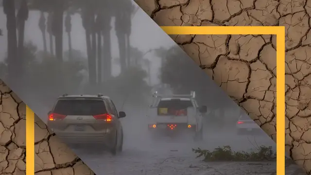
Meteorologists are warning that a powerful El Niño climate pattern intensifying in the Pacific Ocean could evolve into a rare “Super El Niño.”
Show More Show Less View Video Transcript
0:00
It's really, really heavy rainfall
0:03
And then you might spend several weeks in a drought. Just another summer of very little rainfall, high heat
0:15
You can be talking about some pretty big winter storm systems. Those extremes are swinging more extreme and they're happening much quicker
0:30
Between a rise in tornadoes, monumental floods, and extreme highs and lows
0:40
the U.S. could be in for a rough weather ride. They're referring to super and mega El Nino because this one's coming on pretty strong
0:50
Straight Arrow spoke with the National Weather Service about what's got their antennas up this
0:53
year. El Nino is a climate pattern marked by unusually warm ocean temperatures in the central
0:59
and eastern Pacific Ocean, extending toward the coast of South America. Those warmer waters
1:04
influence weather patterns around the world, often leading to higher than normal temperatures
1:09
in many regions. Think of the atmosphere as a series of ripples across the globe
1:14
Some regions get stuck under hotter, drier patterns, while others see cooler, wetter
1:19
conditions. The stronger the pattern, the more extreme those swings can become
1:24
We went from a La Nina over last winter In February we started to see a pretty rapid swing above normal Those above normal temperatures have just continued to intensify all the way from the west coast of South America
1:41
extending along the equatorial portion of the Pacific and over towards about northeast of Australia
1:49
We continue to see those trends and the probabilities for both categories of strong El Nino and very strong El Nino
1:58
continue to increase. So strong, they say the pattern hasn't been seen in more than a century
2:05
The only thing that really compares to what we may expect or the intensity that we have probabilistic data showing it could get to is the stuff back in the late 1800s
2:16
That can make predictions more challenging when the need to be accurate is crucial
2:21
According to NOAA, a miscalculation can mean massive economic losses, crop failures
2:26
and strained water supply and energy grids. When you're talking about science, what you want to do is try to make that correlation
2:33
with a really thick and sound data set. And we just don't have a lot of data for that
2:40
Not a lot, but enough to give them a hint of what could be coming in a super El Nino year
2:46
One thing that we do see in some of the data is that when you start to introduce some of these anomalies over the Pacific
2:53
is you tend to see more intense rainfall on isolated or more local scale type basis here
3:01
Those intensities are great in those locations but then what happens in a lot of cases is that you get this really really heavy rainfall and then you might spend several weeks in a drought
3:14
Those are the type of variables that are happening. Those extremes are swinging more extreme, and they're happening much quicker
3:22
That could add to the drought, flooding, and heat stress in places already dealing with weather challenges
3:27
out west where people are hoping for moisture. What happens next depends on how the pattern
3:33
evolves through the summer. If we start to get into one of those patterns where
3:38
we have that big high pressure in the middle of summer, that is unfortunate news because that would
3:45
be just another summer of very little rainfall, high heat, and you're just building on top of
3:53
one problem that's already existed. And in those areas currently experiencing drought
3:58
a few big rain events may not bring relief. The soil becomes more like a rocky hard surface when
4:05
it's dry and you get the drought. Everything that falls, even if you have six, seven inches of rain
4:09
is mostly runoff. All goes into the rivers or other tributaries. Moving east along major rivers
4:16
like the Mississippi and Missouri, forecasters are also watching for floods. If we do have the
4:23
river levels that are elevated from rain that are outside the area, that just kind of puts us
4:28
more in a cautious approach of keeping an eye on not only rain upstream like it's already been
4:36
but also rain over the local area to make sure that we don approach that flooding criteria That one reason forecasters say they keeping a particularly close eye on the southern U
4:47
Southern part of the U.S., they have a pretty decent indicator that they
4:51
will side or favor with the higher than normal precipitation. The National Weather Service expects the south to lean wetter than normal
5:00
while parts of the plains could trend hotter and drier. On the east coast
5:04
and El Nino typically means more coastal flooding. While Florida might see more rain than normal
5:10
a strong high pressure pattern may actually bring relief when it comes to hurricane season
5:15
It will shear them out or weaken them. It doesn't allow them to become well-established or
5:20
necessarily stronger in that sense. And that's in direct relation to that
5:28
Doma high pressure, that blocking pattern. The one thing that we typically say, though
5:32
is it only takes one. The term super El Nino may grab attention, but how it manifests will
5:38
be different for everyone. The forecasting science isn't a slam dunk, but one thing is for sure
5:44
The one thing that we can say with almost absolute certainty is that El Ninos do lead to
5:50
enhancements of certain extremes, whether that's dry or wet, warm or cold. Those streams could
5:59
either be really localized for a certain region. When I say localized, I mean more regionally
6:06
in comparison to the globe, but they will be placed somewhere
news