
Armenia's Borders Are Wrong
Nov 13, 2026


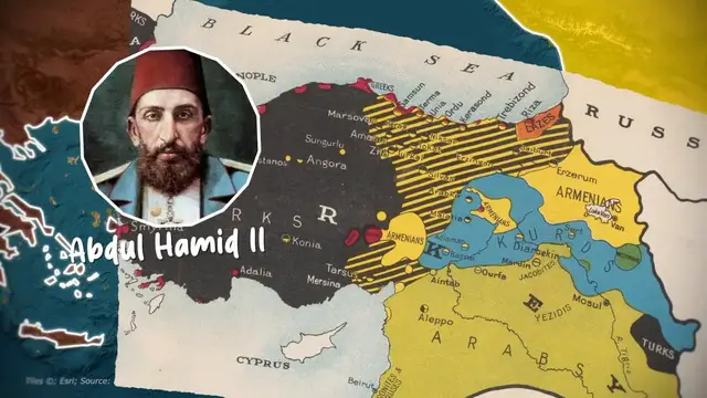
Armenia today occupies less than 15% of its historical homeland, and its national symbol, Mount Ararat, sits across a closed border. How did an ancient empire stretching from the Mediterranean to the Caspian Sea shrink into a landlocked mountain enclave of just 30,000 square kilometers? From the imperial heights of Tigranes the Great to the projected borders of Wilsonian Armenia and modern times, this is the territorial history of how Armenia was partitioned, erased, and redrawn.
Become a member on Patreon & get your name in the credits + exclusive content! https://www.patreon.com/generalknowledge
TIMESTAMPS:
00:00 Armenia Should Be Bigger
02:02 Ancient & Greater Armenia
04:52 Survival in the Middle Ages
05:24 Relocation & The Kingdom of Cilician Armenia
06:25 Ottoman, Persian & Russian Rule
07:55 The Armenian Genocide
08:56 The First Republic
09:37 How Greater Armenia Almost Existed
12:06 Soviet Armenia
12:43 Soviet Attempts at Expansion
13:38 Nagorno-Karabakh Conflict
14:29 A Modern Greater Armenia?
Stay up to date on more content from me:
Tiktok: https://www.tiktok.com/@generalknowledge.pt
Instagram: https://www.instagram.com/genknowledge/
Join the Discord Server: https://discord.com/invite/f4neAVWZfF
Business Contact: [email protected]
#GeneralKnowledge
Show More Show Less