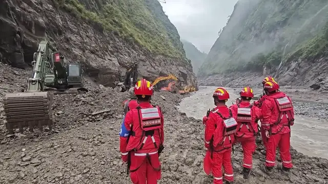

China: Multi-force rescue underway after mudslide in Xizang's Gyirong County.
Aug 29, 2026
Shotlist Gyirong County, Xigaze City, Xizang Autonomous Region, southwest China - Aug 29, 2026 1. Various of rescuers searching for possible survivors 2. Turbulent river 3. Various of rescuers gathering 4. River 5. Heavy machinery along river 6. Various of excavators working 7. Excavators working, rescuers 8. Various of trucks sending reinforcing cages 9. Turbulent river 10. Mountains 11. Monitoring device 12. Heavy machinery in operation 13. Rescuers, communication base station 14. Drone taking off Storyline China has deployed multiple rescue forces, operating via water, land and air, to the core area of the mudslide that struck the Gyirong border port in Gyirong County, southwest China's Xizang Autonomous Region on Wednesday. At about 16:30 Friday, a six-member team from the Xizang Fire and Rescue Corps and 15 members with a search dog from the Sichuan Fire and Rescue Corps arrived at Gyirong Port, becoming the first professional rescue teams to reach the core disaster zone. The mudslide destroyed a section of the G216 national highway leading to the port, seriously hampering emergency response and rescue efforts. China Anneng, a state-owned engineering and rescue enterprise, deployed 60 technical and skilled personnel and mobilized 14 pieces of engineering rescue equipment, including excavators and loaders, to try to reopen the damaged section of G216 national highway. As of Saturday, the road had been repaired up to about one kilometers from the port. Rescuers are using gabions -- metal cages filled with stones -- to build a foundation in the fast-flowing water. The cages are reinforced with large rocks so that they are stabilized on the ground as the foundation for an emergency access route. Local authorities also warned that a barrier lake, formed upstream of the port by the glacier collapse, is in an unstable geological setting and could breach anytime to endanger the rescue operations downstream. According to remote sensing monitoring by the Ministry of Water Resources, as of Saturday morning, the lake's surface area had decreased 21,000 square meters from the original 99,000 square meters, indicating slow overflow through the blockage. Around the clock monitoring has been taken by multiple forces to guard against possible risks. A light detection and ranging (LiDAR) mapping device has been installed at the site to continuously monitor the slope above the work area. If it detects any rock displacement or other dangers, it triggers an alarm, allowing rescue teams to evacuate immediately in case of danger. In addition to the LiDAR device, manual safety observation posts have also been set up on the steep slopes above. Observers are on the watch for any signs of danger such as falling rocks, and will blow whistles to warn rescue teams below if a hazard is detected. Drones are launched from a supply zone three kilometers away from the mudslide-hit port to deliver supplies to rescuers already stationed in the core disaster area. The mudslide, which occurred on the Nepalese side of the Nepal-China border, has caused seven deaths and left 554 others missing in Xizang as of 1 a.m. on Saturday, according to the emergency management department of Xizang Autonomous Region. A total of 2,141 rescue workers and 86 specialists from natural resources and other relevant fields have been deployed to the disaster area. [Restrictions: No access Chinese mainland]
Show More Show Less