Up next in 10


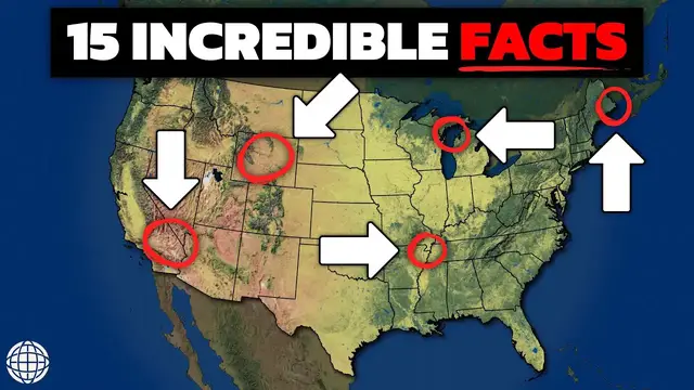
The United States is a VAST country. And this means there's a lot of geography attached to it! Unfortunately, not every fun geography fact about the United States can fit within its own episode. So here are 15 of my favorite geography facts.
Show More Show Less View Video Transcript
0:00
I guarantee you don't know just how weird and fascinating U.S. geography is
0:05
If you want to wow your friends and acquaintances at the next party you go to
0:09
here are 15 incredible facts you need to know about geography of the United States
0:14
And let's start with the state that's both the easternmost and westernmost state in the U.S
0:23
We're talking about Alaska. This fascinating geographic quirk comes from the fact that the
0:28
Aleutian Islands, a very long chain of volcanic islands extending from Alaska into the Pacific
0:32
Ocean, crosses the 180th meridian, the imaginary line that separates the western and eastern
0:38
hemispheres. Because some of the islands lie west of this line, Alaska is both in the western and
0:43
eastern hemispheres, making it technically the easternmost U.S. state. This is an odd distinction
0:49
as we typically associate the easternmost points of the U.S. with places like Maine
0:53
but geographically, Alaska holds the title for both. Since we're already talking about the eastern seaboard
1:03
which state do you think is closest to Africa? It might seem surprising, but Maine is geographically closer to Africa than Florida
1:11
Specifically, the distance from Kwadi Head, Maine, the easternmost point of the United States
1:16
to El Badooza, Morocco, is roughly 3,154 miles. In contrast, the distance from Miami, Florida
1:23
to the same point in Morocco, is about 4,025 miles, making Maine closer by about 800 miles
1:30
This surprising fact is due to the curvature of the Earth and the positioning of the continents
1:34
While Florida sits much farther south and is closer to the equator, which runs through the heart of Africa
1:40
Maine's location is much farther east and Africa extends much farther north than many people realize
1:46
This geographic quirk highlights the often unexpected results of global geography, where straight lines on maps don't always tell the full story due to Earth's spherical shape
1:56
It's a fascinating reminder of how the Earth's geometry can make certain locations appear closer than we might expect based purely on latitude
2:08
The population distribution of the United States is strikingly uneven. If we were to draw a line just west of San Antonio, Texas, about 80% of the country's population would live east of it, while only 20% resides to the west
2:21
This divide reflects both historical patterns and geographic factors. The western side of the country includes major urban centers like New York, Chicago, and Washington, D.C.
2:31
areas that have been developed and densely populated since the colonial era
2:35
In contrast, the western U.S., despite containing large cities like Los Angeles and San Francisco
2:40
is more sparsely populated, largely due to vast stretches of desert, mountains, and wilderness
2:46
The West's harsh and rugged landscapes, such as the Rocky Mountains and deserts of the Southwest
2:51
have historically made large-scale settlement difficult. Even today, much of the land west of San Antonio consists of national parks, forests, and protected areas
3:00
contributing to the population imbalance. And one of the best examples of these sparsely populated western states is Wyoming
3:11
Wyoming is, of course, known for its vast open spaces and rugged landscapes
3:17
But perhaps most notably, it's known for its extremely low population. In fact, Wyoming's population is so low that it actually has more cattle than people
3:27
With a population of just over 580,000, it ranks as the least populous state in the U.S
3:33
Meanwhile, the state's agricultural industry is dominated by cattle ranching, with roughly twice as many cows as people Cattle grazing plays a significant role in the state economy with beef being one of Wyoming key exports This reflects the broader trend in many western states where large stretches of land are devoted to ranching and population densities remain very low
3:59
Stretching approximately 5,525 miles, the longest international border in the world is between the
4:05
United States and Canada. This immense boundary runs from the Atlantic Ocean in the east to the
4:10
Pacific in the west, crossing diverse landscapes such as the Great Lakes, prairies, forests
4:16
and mountains. It also includes the border between Alaska and Canada, which alone spans over 1,500
4:21
miles. Despite its length, the U.S.-Canada border is known for being relatively peaceful and
4:26
unfortified, in stark contrast to many other international boundaries. Both countries maintain
4:32
a healthy relationship and their shared border facilitates extensive trade and cultural exchange
4:37
Additionally, the two countries have various agreements to manage their border, including the Great Lakes-St. Lawrence River Basin Sustainable Water Resources Agreement
4:45
as well as various partnerships for national parks that straddle the boundary
4:53
Speaking of the Great Lakes, Lake Superior, Michigan, Huron, Erie, and Ontario are a global
4:59
freshwater treasure, holding about 21% of all surface freshwater on Earth. These five interconnected
5:05
lakes contain over six quadrillion gallons of water, providing drinking water for over 40 million
5:11
people in the U.S. and Canada. Formed by retreating glaciers at the end of the last ice age, the Great
5:17
Lakes span more than 94,000 square miles and are vital to North America's ecology and economy
5:23
Together, they support a vast array of fish and wildlife and serve as important trade routes
5:27
with shipping channels connecting the heartland of North America to the Atlantic in both the East and South
5:33
Today, the Great Lakes water is protected by the Great Lakes Compact
5:37
a legally binding interstate agreement between Illinois, Indiana, Michigan, Minnesota, New York, Ohio, Pennsylvania, Wisconsin
5:45
and the Canadian provinces of Ontario and Quebec. Sorry to break up your 15 geography facts, but I wanted to give you an extra fact
5:55
Did you know that your body needs about 50 grams of protein and a wide range of vitamins and minerals every single day
6:03
I didn't, which is why I'm very happy that I found Huel. Huel has become my daily routine, not only because it's convenient
6:11
but because it's helped me tackle the most important meal of the day while also giving me everything I need to stay healthy
6:19
In every single bottle of Huel, there's 35 grams of protein and 27 essential minerals and vitamins that make this single bottle 100% nutritionally complete
6:30
That means less feeling hungry and snacky throughout the day and more feeling great and energized
6:36
So if you're feeling like you don't get enough protein, vitamins, or minerals in your everyday diet, come join me
6:42
Right now, you can get 15% off Huel with code GEOFF at Huel.com slash Jeff
6:49
Fuel your best performance today with Huel. Now let's take a look at Colorado
6:58
This state is known for its rectangular shape, but its real borders are not as straight as
7:02
they appear on maps. When Colorado was created in 1876, its borders were meant to follow specific lines of latitude
7:09
and longitude. However, the tools used for surveying in the 19th century were not as precise as modern
7:15
GPS technology, leading to slight inaccuracies. Over time, as more accurate surveys have been conducted
7:22
minor corrections have been made to the state's boundaries. These changes are mostly imperceptible to the average person but demonstrate how geography and human technology can influence the way we define political borders The same phenomenon can be found in other states with supposedly straight borders
7:42
Surprisingly, the largest rainforest in the United States isn't located in Hawaii or Florida, but in Alaska
7:48
The Tongass National Forest, covering over 16.7 million acres, is the largest national
7:55
forest in the country and is also a temperate rainforest. Located in southeast Alaska, it forms part of the Pacific Temperate Rainforest, the largest
8:03
remaining temperate rainforest in the world. The Tongass is characterized by its dense, old-growth forests of Sitka spruce, western
8:10
hemlock, and red cedar, along with a rich array of wildlife including bears, wolves
8:15
and salmon. The forest plays a crucial role in local ecosystems, supporting biodiversity and regulating the climate by absorbing carbon dioxide
8:24
It's also a vital resource for the indigenous communities who have lived in the region for thousands of years
8:29
However, as with other rainforests, the Tongass is threatened by logging and climate change, sparking debates about conservation efforts
8:40
In California, Mount Whitney and Death Valley are only 85 miles apart
8:45
yet they represent two of the most extreme points in the contiguous United States
8:50
Mount Whitney, standing at 14,505 feet, is the tallest mountain in the lower 48 states
8:57
while Badwater Basin in Death Valley, at 282 feet below sea level, is the lowest point
9:03
This proximity between such extreme elevations is a result of the unique
9:07
tectonic and erosional forces that shape California's landscape. Death Valley's basin formed due to the stretching and thinning of the Earth's crust
9:14
while Mount Whitney rose from tectonic collisions. Together, they highlight the dramatic geologic diversity of the state
9:25
The Mississippi River Basin is one of the largest drainage systems in the world
9:29
covering 1.2 million square miles and draining water from 41% of the United States
9:35
The basin spans 31 states and includes major rivers like the Missouri and Ohio
9:40
all flowing into the Mississippi River before emptying into the Gulf of Mexico
9:44
This vast watershed is essential for agriculture, transportation, and freshwater resources in the U.S
9:50
The Mississippi River alone is about 2,340 miles long, making it the second longest river in the country
9:57
behind the Missouri River, a tributary of the Mississippi. The river basin supports a variety of ecosystems, from wetlands and forests to prairies and mountains
10:06
and is home to millions of people and countless species of wildlife
10:10
However, the river system is also prone to flooding and faces significant environmental issues such as pollution from agricultural runoff
10:18
Once these nutrients, vital for farming, end up in the goal, they feed algae, which chokes off any other marine life present
10:25
But the size of the Mississippi is not even the most interesting fact about this famous river
10:30
In 1811 and 1812, a series of massive earthquakes in the central United States
10:39
caused the Mississippi River to flow backward temporarily. The New Madrid earthquakes, as they became known, were so powerful that they caused ground subsidence
10:49
which forced the river to reverse its course in some places. The shaking caused waterfalls to form in certain stretches of the river
10:56
and eyewitnesses reported seeing water moving upstream. This event is one of the most remarkable
11:01
in U.S. geologic history and demonstrates the power of tectonic forces even far away from active fault lines
11:08
Today seismic activity in the New Madrid Seismic Zone still poses a risk to the region The Graveyard of the Pacific is a treacherous stretch of coastline along the Pacific Northwest
11:22
particularly the waters around the Columbia River Bar, where more than 2,000 ships have met their fate
11:27
This notorious area stretches from Oregon's coast to Vancouver Island, British Columbia
11:32
and is infamous for its dangerous weather conditions, strong currents, and shifting sandbars
11:38
In fact, the Columbia Bar is one of the most hazardous river entrances in the world
11:42
Where the powerful Columbia River meets the Pacific Ocean, extreme waves and shifting sand create perilous conditions that have claimed countless ships
11:50
This hazardous area has been a threat to ship captains for centuries as stormy weather
11:55
dense fog, and sudden changes in water depth frequently cause vessels to run aground
11:59
capsize, or collide with hidden obstacles. Efforts to mitigate these dangers have included the construction of lighthouses
12:06
jetties, and a highly skilled team of Columbia bar pilots who help guide ships safely across the bar
12:12
Despite these measures, the region's volatile nature continues to make it a dangerous area
12:18
for navigation, maintaining its reputation as the graveyard of the Pacific. Kentucky's Mammoth Cave National Park is home to the longest cave system in the world
12:30
with over 400 miles of explored passages and potentially many more yet to be discovered
12:36
Mammoth Cave has a rich history, with indigenous peoples using the caves thousands of years ago
12:40
and modern explorers continuing to map its vast network of tunnels. The cave system is formed from limestone and shaped by the slow action of groundwater
12:48
eroding the rock over millions of years. It contains a diverse array of subterranean ecosystems, including unique species of fish and bats
12:57
The cave's size and complexity make it a marvel of natural geology
13:00
Did you know the U.S. is home to both hot and cold deserts
13:08
Unlike the hot deserts of the American Southwest, the Great Basin, located in Nevada and Utah
13:13
experiences cold winters, often with snowfall. However, as temperatures rise and precipitation patterns vary due to climate change
13:21
the desert's boundaries are slowly extending. This expansion impacts local ecosystems, water resources, and agriculture
13:28
The Great Basin is already one of the driest areas in North America
13:32
and its growth highlights the broader environmental challenges of a warming planet
13:40
Hawaii, specifically the Big Island, is the only U.S. state that's physically growing
13:46
This is due to the ongoing volcanic activity of Kilauea, one of the most active volcanoes on Earth
13:52
When lava from Kilauea flows into the ocean, it cools and solidifies
13:56
adding new land to the island's coastline. Over the past few decades, Kilauea has continuously erupted
14:02
increasing the island's size by hundreds of acres. The volcanic activity also shapes Hawaii's landscapes
14:08
from black sand beaches to towering lava cliffs. While the eruptions can be destructive to human settlements
14:13
they are also responsible for creating the fertile, lush landscapes that make Hawaii so unique
14:18
There's many more fascinating geographic facts about the United States, but those will have to wait for another video on another day
14:26
Until then, send me your favorite fun geography facts about your state or country
14:31
Who knows? Maybe they'll be made into a video. You just learned a lot of geography, and now you can showcase that geography right on your
14:38
walls by buying a map from my map store. Every map you buy helps support this channel
14:44
I hope you enjoyed these bite-sized geography facts about the United States. If you did, please like the video and subscribe to my channel
14:51
And if you want to watch more videos, you can do so here. Thanks for watching. See you next week
#education