menu
All
Channel
search
Log in
Join Open.Video
Log out
Up next in
10
CANCEL
PLAY NOW
Please enable JavaScript
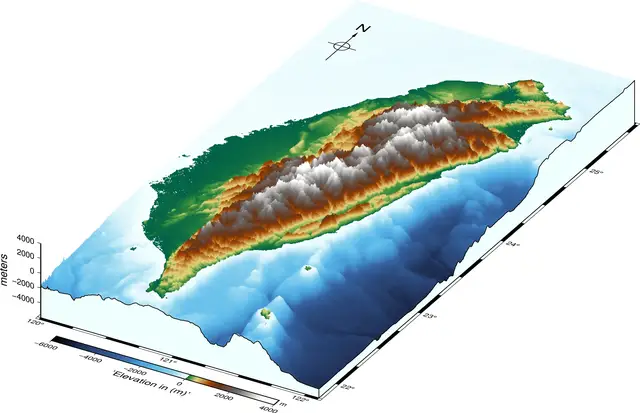
Plot three dimensional geospatial map in Python
May 9, 2021
Share
0
0
Share
0
0
earthinversion.com
Subscribe
Tutorial on how to plot #three-dimensional perspective map using Pygmt in Python. The script also downloads the high-resolution data using the #PyGMT API. The code runs fairly fast because it is running Generic Mapping Tools (#GMT) as a core.
Show More
Show Less
#Engineering & Technology
#Other
#Other
×
2026-05-14 15:13:39